

UMD Researchers are Helping Kenya Create its Own Agricultural Data Infrastructure
A Potential Model for Other Countries, the ADAPT Project is Supported by $4.9M from the Gates Foundation and a $2.5M In-Kind Gift from Microsoft’s AI for Good Lab
Despite recent technological advances and the global rise of artificial intelligence, too much time continues to pass between the production of important agricultural data and the time at which that data would have been most useful to farmers.
Steered by multiple Kenyan government institutions, including the Ministry of Agriculture, the University of Maryland-led NASA Harvest program aims to close that gap by creating a system through which it can use satellite images and AI to consistently produce its own, in-season agricultural data products that government officials, farmers, agribusinesses and insurers can depend and act on in a more timely way.
Called AI‑enabled Data for Agriculture Products & Transformation for Kenya (ADAPT-Kenya), the initiative brings together working groups focused on cropland and crop-type mapping, area estimates and crop statistics, yield estimation, early monitoring, insurance services, and market and trade intelligence—and has already supported the government’s response to the current drought.
“The idea here is not to do ‘another project,’ in which you have three years of funding, you demonstrate a cool technological capability, and then the project is over and you go on your way,” explained Inbal Becker-Reshef, the director of NASA Harvest, a research professor in the Department of Geographical Sciences, and Managing Director of the Microsoft AI for Good Lab. “We’re really aiming to develop something that will be sustained into the future; a geospatial agricultural data backbone that is owned and run by the government, and, if we are successful, scale this out to other countries.”
The researchers decided to start with Kenya given their work on other projects in the area—like the GEOGLAM Crop Monitors—and the country’s agricultural diversity.
“The western part of the country is very productive, while you have a lot more marginal areas in the rest of the country,” said Becker-Reshef. “There is a lot of variation there that makes this project interesting and challenging, and if we can do it, then that’s helpful for learning and scaling.”
As an added bonus, the Microsoft AI for Good Lab—which contributed $2.5 million of in-kind support to the project, in addition to The Gates Foundation’s $4.9 million grant—has a team of AI scientists situated in Nairobi, Kenya’s capital. The research lab has worked with a wide range of Kenya-based partners, including government institutions, UN agencies, and non-profit organizations across multiple sectors over the years. In direct partnership with Kenyan officials, the teams are collaborating on crunching numbers and applying machine learning algorithms to the satellite imagery, producing crop maps and agricultural information products.
Ultimately, the outputs of the project will be national cropland and crop-type maps, yield forecasts and crop-condition monitoring reports, and field boundary datasets that are to be made openly available to the public during the growing season, when there is still time to make adjustments. The team also plans to create systems that can provide early warnings about droughts, floods, or other natural disasters.
“In the past there was this kind of illusion that there was a market for selling crop-type maps and these other kinds of data products,” Becker-Reshef said. “But what we are actually seeing is that we get so much more value if we start with a base data layer as a public good, and then let applications be built on top of that. Because if people think ‘this is just going to be here for two years’ they're not going to develop products and services on top of those layers.”
Becker-Reshef says that most countries around the world lack a system that regularly produces timely agricultural data products like NASA Harvest and Kenya are setting out to establish. She says that in the United States, for example, the Cropland Data Layer—which shows what crops are growing in the country’s fields—is released to the public several months after the growing season.
“This is a very ambitious project, we have no illusions about that. But we feel like this is something that could really substantially support a lot of data and information products that are really critical across the agricultural space,” said Becker-Reshef. “This will be a real test of that.”
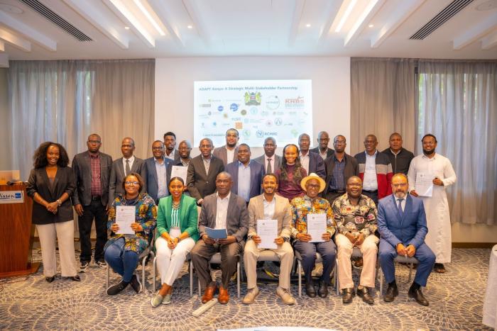
Photo of partners from diverse institutions gathered to formally establish ADAPT-Kenya provided by Mary Mitkish, program manager and communications lead for NASA Harvest.
Published on Thu, Sep 10, 2026 - 10:44AM